Spectral remote sensing involves the collection, processing and interpretation of electromagnetic energy that is reflected or emitted from features on the Earth’s surface. The fundamental premise is that different materials reflect and emit energy at different wavelengths and can be discerned accordingly.
In mineral exploration, spectral imagery can be used for a variety of applications that include:
- Logistical planning
- Indicator mapping
- Geomorphological mapping
- Lithological mapping
- Mineral/alteration mapping
- Structural mapping
Related applications include mine planning and environmental monitoring. Some sensors also collect stereo imagery that enables the creation of elevation models.
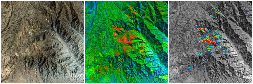
Spectral imagery can be particularly effective where the type of mineralisation being sought is associated with geological characteristics that are spectrally distinct, such as a specific host rock or alteration type. Some of the major deposit types that can be identified using spectral imagery include porphyry copper-gold, epithermal gold, orogenic gold and volcanogenic massive sulphides.
Using spectral imagery in mineral exploration is associated with numerous advantages that include:
- Being able to consider large areas cost-effectively
- Providing an elevated vantage to identify features less visible at ground level
- Being able to identify features not visible to the human eye
- Using imagery that is often readily available “off-the-shelf”
- Being able to acquire some types of imagery for free
- Using a discrete and confidential means of exploration
- Not requiring permitting
- Having a very low environmental impact
Like other exploration methods, spectral remote sensing is associated with some limitations. Fundamentally, it can only detect what is exposed at the surface and, consequently, anything obscuring the features of interest (for example, snow/ice, vegetation, shadow, urbanisation, etc.) can hinder its effectiveness.
SRK ES are experienced in all forms of spectral analysis and retain the most modern and up-to-date remote sensing approaches. SRK ES routinely acquires, processes and interprets spectral imagery to facilitate mineral exploration, particularly for logistical planning, identifying artisanal mine workings, remote geological mapping, assessing regional prospectivity, area selection and target generation.
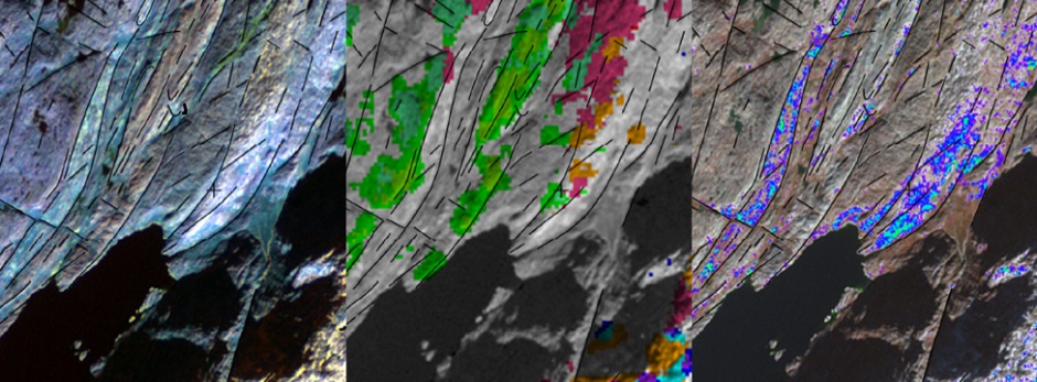
A recently completed project in Saudi Arabia, targeting volcanogenic massive sulphide (VMS) mineralisation, involved the selection, acquisition, processing and interpretation of Landsat 8 and Sentinel 2 multispectral data. The derived spectral imagery was used to facilitate remote lithological, structural and mineral (iron oxide and clay) mapping, and in identifying targets. These targets were subsequently verified on the ground and resulted in identifying additional mineralised zones.